
My last visit to Canning Town was in Summer 2018 when I walked the length of Barking Road (A124) But before doing so I then paid a visit to the new City Island. This time this is where I started my journey hoping that the banks of the Lea River would be open to take me up to its mouth. But it is still closed and for good reasons I suppose. I had to make my way through the Limmo peninsula (aka City Island) in order to start my loop around Canning Town. This part was short-lived as I was being asked to leave the perimeter as the land was now private and therefore required an authorisation. To photograph with a high-end mobile phone didn't seem to be an issue but doing it with a standard Fuji mirrorless seemed to be one. I didn't want to go into lengthy discussions with the security guys and preferred to enjoy this glorious day of early Spring (the view from afar was much better anyway) Took the Lower Lea crossing and so much is raising. Ballymore which is in charge of City Island is also in charge of the Goodluck Hope residential area on the waterfront facing the tip of North Greenwich and the Millennium Dome. Meaning that the mouth of the Lea River has become private property! - Unbelievable - How did that happen? Anyway moving on. The whole of the waterfront is now under construction and I suppose it will link in few years with the new development further down in Silvertown.
Map description: YELLOW DOTS my walk BLUE completed after Olympic Games PINK under construction GREEN land clearing ORANGE land waiting RED future prospects (this map is a personal interpretation)


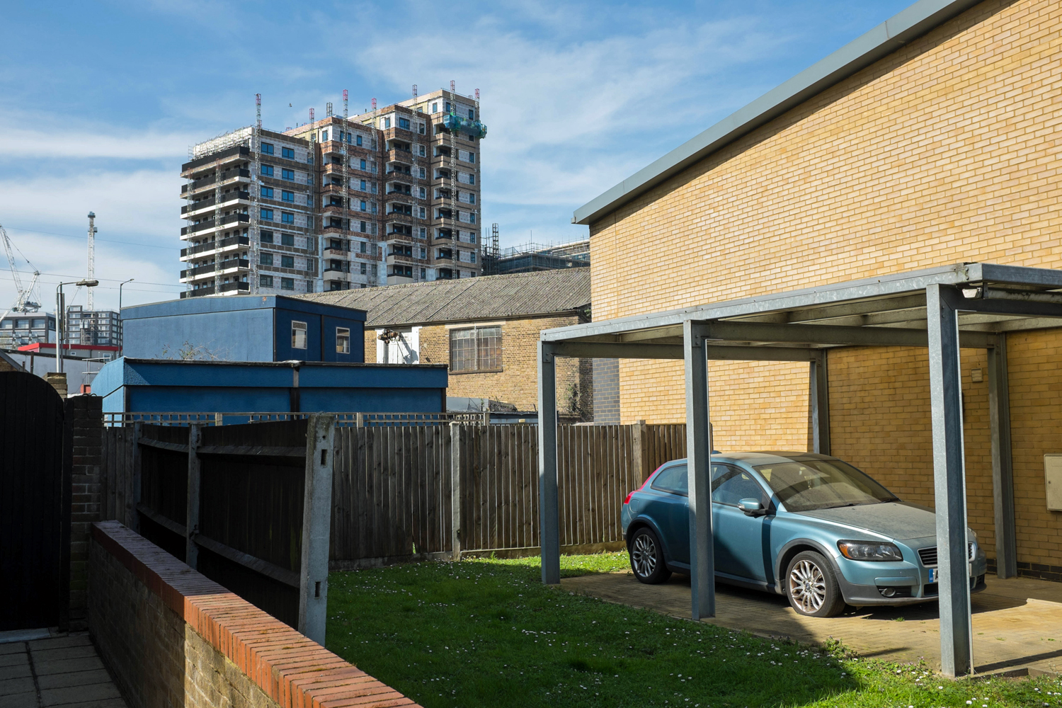
I have now passed the A1011 and I am making my way up North. I have to walk through the London Royal Docks and its futuristic display. I then pass over the DLR to enter an older part synonymous with post-War regeneration. It is finally quiet but the high constructions are creeping in from behind. I walk through Keir Hardie recreation ground built in the 50's but seems like it has had a recent facelift - looks good. I then enter the belly of the whale. The A1011 has turned into two gigantic walls facing each other and I people look ridiculously small and insignificant. It is midday and the sky is blue but I feel trapped like in a box. It's all property. It is well located and it can take on a lot of people. And my first question is where are the extra greens spaces? The park I just left was designed for a dense low architecture. Today you can squeeze as many families in just one block and where do they go to revitalise. Playgrounds are good for kids but what about teens, adults and elderly? Where can they relax and gather. There is almost nothing down there by the river. It's just concrete after concrete, very sterile vision. Worrying...


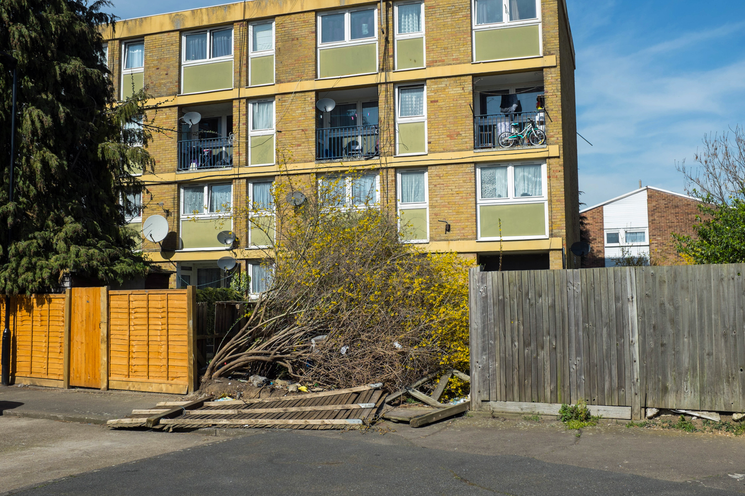
I decide to leave the high rise and venture a bit along Newham Way (A13) This is a vision of poverty, an abandoned fringe of the population. The estate is not fit for purpose anymore and will be erased soon I bet. Visions of utopia, madness and misery. A good day from a documentary perspective I guess.
I had to post this last image SHOPEAT SOCIALISE CANNING TOWN, yeah right!...


No comments:
Post a Comment